

Deer hunting is allowed here by D&R Greenway permission from early September to mid-February, except on Sundays. Wear an orange hat or a bright jacket and stay on the trail during the season.
Sourlands Ecosystem Preserve At A Glance...
- Picnic Rock, a big flat rock in the woods, is made for a trail snack.
- More than 150 bird species have been recorded in the Sourland forests.
- Cross the Stony Brook near its headwaters, at the crossing with a handrail or on the boulders just downstream.
- Todays Sunrise: , Sunset:
- New Jersey Delaware River Region Mercer County
About Sourlands Ecosystem Preserve
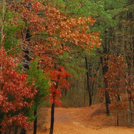
The Sourlands Ecosystem Preserve, once called the Northern Stony Brook Greenway Preserve, is 375 acres of forest owned by the D&R Greenway Land Trust around the headwaters of the Stony Brook. It sits on Sourland Mountain in East Amwell Township, with its larger southern part in Mercer County, and it is one link in a chain of forested land along the Sourland ridge.
The Sourlands region covers about 60,000 acres of central New Jersey, and its big, unbroken forests are home to more than 150 recorded bird species, many of which need that closed-canopy forest to nest. D&R Greenway has helped preserve more than 3,400 acres here.
The trails are easy, walking and hiking only, and marked with D&R Greenway's triangular markers. Kiosks with trail maps stand at several trailheads.
-
Activities:
- Hiking
- Walking
Amenities:- Parking Lot(s)
Trails:- Flat / Easy
Park Type:- Preserve
Rules/Regulations:- Biking Not Permitted
- Horseback Not Permitted
- Must be Leashed
Contact / Location
Trail & Path Info
The Mountain Road loops start at the main gravel lot and kiosk on Mountain Road: the yellow loop is 1.3 miles, the blue trail 0.6 mile and the orange trail 0.5 mile, 2.4 miles if you walk them all, or about 1.9 miles as a true loop. Soon after the lot the trail passes a small vernal pool.
The Picnic Rock Loop (2.1 miles, green markers, with a short stretch on Mountain Church Road) climbs gently from wet woods to Picnic Rock, a perfect spot for a snack. It combines with the Double Crossing Loop (1.5 miles) for a 3.1-mile walk. The Featherbed Lane Connector (0.4 mile), Sourlands Foothills Trail (1.1 miles) and Rileyville Road Connector (0.2 mile) link to other lots and neighboring preserves.
There are boulders along the Stony Brook in a few spots, and the trail north from Mountain Church Road toward Picnic Rock is often wet, so wear waterproof boots. After heavy rain the stream crossing with the handrail can be underwater; there is a good crossing on boulders about 100 feet downstream. A loop takes anywhere from 20 minutes to 3 hours.
Admission & Guidelines
Walking and hiking only: no bikes, horses or motorized vehicles. Dogs are welcome but must be leashed at all times, and please pick up after them, since the preserve protects ground-nesting wildlife. The trails are not stroller or wheelchair accessible.
Parking
The main lot is a gravel lot for 8 to 10 cars on Mountain Road, 0.7 mile west of Rileyville Road. For Picnic Rock and Double Crossing, park along Mountain Church Road near the kiosk (it is narrow with no shoulder). The Featherbed Lane and Sourlands Foothills trails have small lots on Featherbed Lane, and the Rileyville Road Connector uses the Hunterdon County preserve lot across Rileyville Road.
You may also like...
Nearby Places
Sourland Mountain Preserve is farther northeast on the same ridge in Hillsborough, Baldpate Mountain is to the southwest near Titusville, and Sourland Cycles is in Hopewell.
Here are 10 places near Sourlands Ecosystem Preserve
- Sourlands Ecosystem Preserve (~0 miles)
- Unionville Vineyards (~1 miles)
- Pine Creek Miniature Golf (~3 miles)
- Old York Cellars Winery (~3 miles)
- Sourland Cycles (~3 miles)
- Black River and Western Railroad (~4 miles)
- Bessie Grover Park (~4 miles)
- The Watershed Institute (~4 miles)
- Derwood Farm (~6 miles)
- Hopewell Valley Vineyards (~6 miles)
- Kunkel Park (~6 miles)
- Sourland Mountain Preserve (~6 miles)


Hopewell, New Jersey 08525