Teetertown Ravine Nature Preserve At A Glance...
- Todays Sunrise: , Sunset:
- New Jersey Skylands Region Hunterdon County
About Teetertown Ravine Nature Preserve
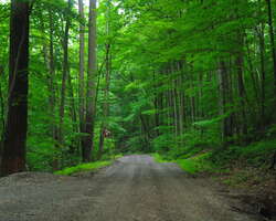
The Teetertown Preserve's 300+acre property is one of the most significant natural areas in Hunterdon County. The ravine section of the park offers the solitude of a densely wooded area, including a variety of hardwoods, shrubs, and animal life. It also contains the contrast of a spectacular rushing stream winding its way through the Ravine's dramatic rock outcroppings. The Mountain Farm section includes large fields and two ponds. Rare birds, such as Bobolinks, have been seen here, and a Bluebird trail is maintained by a volunteer. In 2004, the 232-acre Crystal Springs Section was added, immediately across Pleasant Grove Road (see separate brochure). As its name implies, this section is an important source of water for New Jersey. Its five ponds represent the headwaters of the Spruce Run Creek, and is one of the primary sources for the reservoir of the same name.
-
Activities:
- Equestrian / Horseback
- Fishing
- Hiking
- Jogging / Running
- Mountain Bike
- Skiing / Snowboarding
- Walking
Amenities:-
Restrooms/Bathrooms
When the park is open.
- Parking Lot(s)
- Nature / Environmental Center
- Picnic / Sitting Area
- Picnic shelter(s)
- Picnic tables
Trails:- Flat / Easy
- Rugged / Rocky
Park Type:- County Parks
- Park (General)
- Scenic Areas (overlooks/waterfalls)
Rules/Regulations:- Alcohol Not Permitted
Contact / Location
- Primary Address:
- Get Directions Lebanon Township, NJ 08826
- Contact:
-
- Website
Our Personal Take...
We visited this park one day after randomly seeing a sign for it along High Bridge-Califon Rd. As soon as we drove into this park, we were in love :) The wooded trails were nice, but found a few overgrown spots along the blue trail. Other then that we can not wait go back!
Trail & Path Info
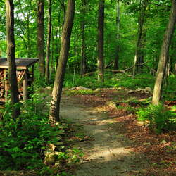
The trails around the park consist of mowed paths through the fields, and more rocky trails in the woods. The grass within the mowed sections was short (maybe 4 inches tall), and well maintained. The wooded trails are more rocky, and parts of the blue trail were very overgrown (like no one has walked there all year) when we visited in early August. If you are looking for a trip recommendation, you might want to consider checking out the "Hike Recommendation" below.
Trip Ideas
This is a fun park top stop by while visiting the area. Depending on your activity level, this may be a challenging afternoon hike or one of many that day. We have been told that people will swing by hear after a hike in Hacklebarney State Park|, or even visit Teetertown for a picnic after a hike in RelCntlinkID!!6759||Schooleys Mountain County Park.
Hike Recommendation
One Hike Recommendation we would have will allow you to see a good amount of the park. This path will offer a few miles of hiking, and a good bit of elevation change. You will also get to check out the old mine ruins... - Park off Pleasant Grove Rd (at the main parking area). - Head along the mowed path passed the 2 fishing ponds, towards the the camping area. - Pick up the Red trail at the north eastern side of the camping activity field. - Follow the red trail, passing where the red and white trails merge. About .22 miles passed this, the white trail turns to the left, heading downhill. - Follow the white, until you hit the Geology Trail on your right. - Follow the Geology Trail down to the road. - Explore this area a bit, enjoying the beautiful stream and the old mine. - Head back up the GT, following the white back to where the White and Red split. Make a left onto the red trail - The red and blue merge just ahead. Follow the Blue trail. - You will only be on the blue trail for a few hundred feet, and go over two bridges, when you need to start looking for a small trail to your right that brings you out to the mowed field paths once again. - Once on the field path, take your first left (onto another mowed field path) - Follow this along the field until it dead ends onto a the dirt road, and take a left - Follow the dirt road to the first intersection (a road coming in from the right), and make that right. Follow this back to your car. For the full map of this, please click here.
Parking
There are two parking areas at the Mountain Farm Section. There is also parking near the campground, but we are not sure if these are for campers only. Driving along Hollow Brook Road will offer a nice drive along a beautiful stream, along with glimpses of the old mine and the Columbia Trail connection. There are a few pull-offs for parking along this road.
You may also like...
More To Explore in Teetertown Ravine Nature Preserve
Nearby Places
- Teetertown Ravine Nature Preserve (~0 miles)
- Teetertown Camping Area (~0 miles)
- Ken Lockwood Gorge Wildlife Management Area (~5 miles)
- Voorhees State Park (~5 miles)
- Schooleys Mountain County Park (~5 miles)
- Voorhees State Park Campground (~5 miles)
- Voorhees State Park Observatory / NJAA (~5 miles)
- Donaldson Farms (~5 miles)
- CK Hoffman Veterans Memorial (~6 miles)
- Union Furnace Preserve (~6 miles)
- Hacklebarney State Park (~6 miles)
- Cooper Gristmill (~7 miles)
Looking for more?
Post Comments
Related Content
Photos
Photos Of: Teetertown Ravine Nature Preserve (Aug 2014) - 08/04/2014
In early August, 2014, we were driving in Hunterdon County and found a park that was new to us -- Teetertown Ravine Nature Preserve. We
DetailsPhotos Of: Teetertown Campground (Aug, 2014) - 08/04/2014
In August of 2014, we found Teetertown Preserve in Hunterdon County. While exploring the park, we quickly stopped into the rustic campg
DetailsPhotos Of: Teetertown Ravine, Hollow Brook Rd (Aug, 2014) - 08/04/2014
The Teetertown Ravine can be easily viewed by car, heading down the Hollow Brook Rd. It is certainly a pretty drive.
DetailsBlogs
Photos of the week! April 14
Each week we share a few photos of fun places around NJ with the hope that you find fun places to explore. In this episode, we visit Gr
DetailsHave you visited the NJ Outdoor Map yet? You should...
We started working on a new site that will help you find new places to explore. It is called the NJOutdoorMap.com
DetailsA Special Time to Stargaze: 2016 Perseids Meteor Shower
This year is setting up to be one of the best years for seeing the Perseids Meteor Shower. With a projected rate of 50 - 150 per hour,
Details


